Geomorphology: How the Knysna Heads were formed
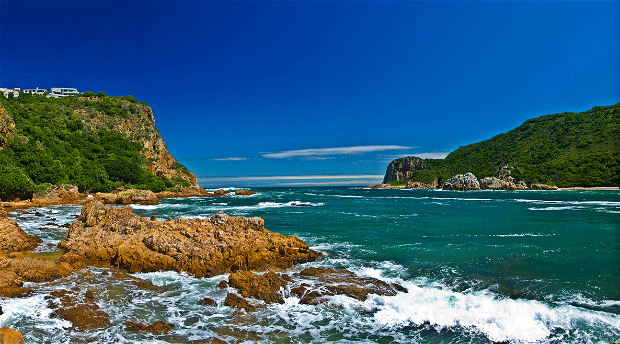
What forces formed the Knysna Heads? Also: a look at some of the features of the Knysna Estuary, at the history of the river mouth, and at the origins of the name, 'Knysna.'
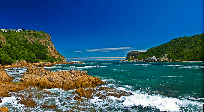
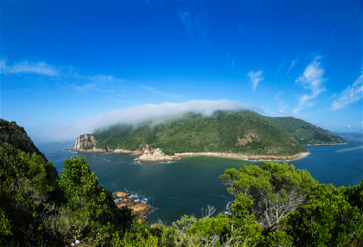
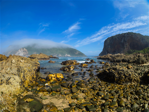
In layperson’s terms, the Knysna Heads can be described as the rocky headlands at the western and eastern ends of the two peninsulas that embrace and define the Knysna basin. They also frame the Knysna Estuary’s only entrance to the sea.
How The Knysna Heads were formed
The Peninsula Formation quartzites visible at Coney Glen - the beach on the Eastern Head - exhibit intensely fractured breccia zones (faults) and similarly-orientated jointing that lie in a northwest-southeast direction. This deformation is related to the formation of the Knysna half-graben faulting that occurred during the break-up of the supercontinent, Gondwana.
Rivers will naturally exploit zones of weakness in the underlying geology, and the slow-flowing Knysna River, meandering across the coastal plain, will have eroded downwards through the intensely fractured quartzite at the same pace as the coast gradually uplifted (this Tertiary Period uplift, which raised the level of the coast by some 500 meters, began 60 million years ago, and ended about 5 million years ago).
The Heads were therefore formed when the Knysna River cut a channel through a ridge of hard Peninsula Formation quartzite (commonly known as TMS, or Table Mountain Sandstone).
The Knysna River mouth
Commonly known as The Heads, the Knysna River mouth is about 230 metres wide.
- Tidal rise and fall at spring tide: about 1.8 metres;
- Average tidal flow at the mouth: 1,000 cubic metres of water per second - with a maximum flow of 2,000 m3/s;
- Maximum speed of the current: 1.27 metres per second
- Navigable channel: about 100 metres on the western side of the mouth are navigable; the eastern portion is blocked by submerged rocks. A submerged sandbar across the mouth further limits navigability (it’s the reason why earlier books and documents describe ships or boats entering or leaving the Estuary as ‘crossing the bar’).
- Depth of the channel: about 3.9 metres at low tide.
Read on for more information about
- The Knysna Estuary
- Navigating The Heads
- The name ‘Knysna’
- The history of The Heads
The Knysna Estuary
The 1633 ha Knysna River Estuary is fed by a number of small rivers and streams that drain a catchment area of about 350 km2. The largest and longest of these - the Knysna River - is only about 64 kilometres from its source in the Outeniqua Mountains to the mouth at The Heads.
- Fresh water: The flow of fresh water from the Knysna River into the estuary is generally quite slow: usually around 5 cubic metres per second at the Charlesford Weir, which is situated just above the level of influence of the tides. (Estuaries of South Africa edited by Brian Allanson and Dan Baird. Cambridge University Press 2009)
- Navigable channel: The channels and sand banks of the Estuary are clearly visible at low tide. The navigable channel is about 19 km long, and 2 km at its widest. The first 5 km (measured from the Heads) are navigable for deep-keel yachts and small ships. Above the railway bridge, small craft can travel for about a further 14km. The average depth of the channels is between 1.2 and 1.5 metres below mean sea level, with a maximum depth of about 16 metres.
- Tidal Influence: The tidal influence (tidal reach) stretches 17 km upstream from The Heads. The time-lag between low tide at The Heads and low tide at Old Drift (near the Charlesford Weir) is about two hours at spring tide.
- Islands and causeways: The 84 ha Thesen Island (previously Paarden Eiland, now a residential suburb with shops and hotels) and the 82 ha Leisure Island (a residential suburb) are connected to the mainland by man-made causeways. The Estuary is bisected by a railway causeway with bridges that run from Belvidere to the town shore. These obstructions tend to slow the natural speed of the tides, which leads to siltation (when the speed of flow of a body of water is slowed, the silt particles it carries settle out).
Navigating The Heads
Skippers entering the Knysna Estuary (also known locally as the Knysna Lagoon) must be in possession of the relevant chart, which will provide detailed information for safe passage.
- For general information about navigating The Heads, please see knysnayachtclub.com
- For assistance, please contact NSRI Knysna Station 12: Emergency number: 082 990 5956
The name ‘Knysna’
The name Knysna has appeared in various spellings since about the 1770s. It was ‘Nysna’ in one of the earliest letters from James Callander (who built a home for himself at The Heads, and who drew the first map of the estuary) to the Governor of the Cape Colony, Lord Charles Somerset - but by the early 1800s, the current spelling - Knysna - seems to have been universally accepted.
The origin of the name isn’t clear: various writers have suggested that it might have come from the Khoekhoe language term ‘xthys xna’ - which the writers believe could mean ‘place of timber’, ‘place of ferns’, or even ‘straight down’ (referring to the cliffs at The Heads).
It’s worth noting that similar place names exist in other parts of Africa, though. A good example would be the old name for Lake Malawi, which used to be known as Lake Nyasa.
Interestingly, Webster's Universal Dictionary (The World Publishing Company, New York, 1940) defines the word ‘nyanza’ as a noun `(African): An expanse of water, as a lake or wide river,' while the Random House Unabridged Dictionary of American English (online, 2019) gives it as:
“ny•an•za (nē an′zə, nī-) n. (in central and East Africa) a large body of water, esp. a lake.
"Etymology: Bantu language of the region; compare Shona nyanza lake, sea”
A brief history of The Heads
People have lived at The Heads for at least 300,000 years.
During periods of low sea levels - when the ocean would have lain as much as 90 km to the south, and the Knysna River would have flowed between The Heads and out onto the now flooded Agulhas Plain - The Heads would have formed a natural bottleneck that would have presented an ideal ambush site for hunting (see our page, Early Stone Age archaeology in Knysna).
At other times - when the sea level was higher, and the ocean entered the Knysna Estuary as it does today - the presence of seafood on the rocky shores, and the shelter offered by caves in the cliffs would have been attractive to the hunter-gatherers of the day (see our page, Middle Stone Age archaeology in Knysna).
The recorded history of The Heads goes back only as far as the 18th Century, though - from about the time (1770) when the Colonial Government proclaimed the farm Melkhoutkraal, on the eastern shore of the lagoon. Melkhoutkraal included all the land from the Eastern Head to the present-day Industrial Area and was granted for a period of one year on loan permit to a burger named Stephanus Terblans (who gave his name to the Terblans beech tree in the Knysna forests: Faurea macnaughtonii.)
Similar farms were declared at Belvidere and Brenton (which was then called Uitzicht), but the north shore of the lagoon (where Knysna’s CBD stands today) remained uninhabited.
The settler population of the district grew only slowly in the late 1700s. In 1802 (during the Third Frontier War, 1799 - 1802), though, the area was invaded by Khoikhoi warriors, who burned down most of the farms between Plettenberg Bay and the Keurbooms River - and also some at Knysna, including Melkhoutkraal.
Although some of the settlers were evacuated to Mossel Bay, many of them left the region permanently.
In 1804 (during the second Dutch occupation of the Cape Colony 1803 - 1806), a British official named George Rex bought Melkhoutkral, and settled permanently there.
Having realised the enormous commercial potential of the area, Rex immediately began lobbying the Colonial Government to establish a harbour at the Knysna for the export of timber from the evergreen Knysna forests. (He would eventually employ as many as 400 slaves to harvest that timber.)
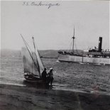
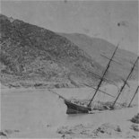
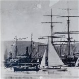
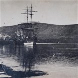
The Knysna Estuary was declared a port in 1817 (although harbour facilities would only be built much later), and in the following year, 1818, the Emu became the first ship to attempt to enter the river mouth - but she floundered and was wrecked on a submerged rock in The Heads.
HMS Podargus arrived to conduct salvage operations two months later, and, since she entered on the western (clear) side of the mouth, became the first ship to safely enter the Knysna harbour.
In 1819, John Gough became the first permanent pilot at The Heads, responsible for the safety of craft crossing the bar. He and his crew were required to row out to ships at sea to guide them in to the lagoon. Gough was replaced by Edward Wallace in 1821.
In 1820, the British Navy established a dockyard on the banks of the lagoon. It seemed like a good idea because of the huge timber resources that were available locally. Its buildings were burned down twice, though, and it was closed altogether after only five years.
In 1827 the port was de-proclaimed for economic reasons, and the pilot was sent off to another posting. John Rex, son of George, then acted as a voluntary pilot for the next thirty years - although he was eventually officially appointed to the post in 1858 - although he died just three days after receiving the news.
In the first half of the nineteenth century, loading and unloading of ships was extremely difficult at Knysna. Cargo was offloaded onto rafts or smaller boats and rowed to shore, or, for larger items, the ship would be hauled onto a sand bank at high tide, and the cargo put off directly onto the mud at low water.
In 1855, local businessman Skipper Horn employed John Benn, a shipwright from Mossel Bay, to come to Knysna to salvage the Musquash, which had gone down at Coney Glen in The Heads. Although the ship broke up before Benn arrived, he decided to stay in Knysna when Horn offered him work to build a new ship - the Rover.
In 1867, Horn completed the town’s first stone jetty, which he’d built at his own expense (the Colonial Government had refused to help with the costs despite the fact that it would benefit the economy). This jetty - upon which the Knysna Yacht Club now stands - served the needs of the shipping community until 1883, when the Government Jetty on Thesen's Island was completed.
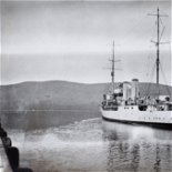
Benn was appointed to the post of pilot at The Heads in 1868, and so became the first of a dynasty of five Benns that would rule the mouth until the harbour was closed in 1954 (the railway line - which was completed in 1928 - and improved roads and fast vehicles had made transport by land cheaper, more efficient and much safer than by sea).
In 1969, a number of fishermen and sailors met at a local hotel to form a National Sea Rescue Institute station for Knysna. The volunteers at Knysna’s NSRI Station 12 have assisted numerous boats, ships, and individuals in The Heads, along the coast, on the lagoon, and inland ever since.
- Please see our page, NSRI Museum for more information about Knysna Station 12
- Please see our page, Maritime Collection for a more detailed history of the Knysna Harbour.
Author
- This article was written for the Knysna Museum by Martin Hatchuel
- Thanks to geologist Fred van Berkel for help and guidance
- The Heads images: Ian Fleming Photographic

Share This Page